In 2005 Tuon Van from Cambodia contacted the TVNI and requested assistance to stabilize the bank of the Mekong River that was adjacent to his farm.
Please note that this presentation as yet does not have a final ending! Actions and results, thus far, are shared with visitors to this site as the problems of river bank erosion are complex and and often difficult to solve. You will see that some problems are being solved others remain. We hope that in the end there will be a workable solution.
You should look at this page as a sort of dairy of events, with new bits of information added from time to time. Its a real story about a real problem that still remains to be solved.
.
Up dated April 24 2008
This is his story ---
Description:
The land is located on national road no. 6, 30km north of Phnom-Penh, Cambodia. It is of a rectangular shape, measuring approx. 10 hectares.
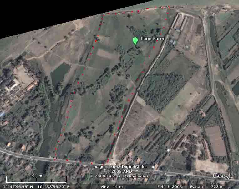
The front side faces the national road, the back borders the Mekong river and the right and left sides are natural canals which during raining season, are full of water from the Mekong; the water then flows along the sides of the land to reach the other side of the road through 2 bridges.The Google map below shows the farmland located between the two bridges on highway 6 (bottom) and the Mekong (top). These images were taken some years ago before any shaping of the bank or planting of vetiver took place. From recent ground photos it looks as though a lot of land has been lost. Interestingly it appears that just to the north of Tuon's land the erosion is much more severe (where river flow is deflected from the island towards the land and again is very severe some 1200 meters to the east of Tuon's land where the river flow from the eastern channel (coming from behind the island) is hitting the west bank of the Mekong). Use the zoom in and out on the map below to see relative location of farm to the Mekong and its flow.
Mekong River Bank Stabilization in Cambodia
Problems:
The land faced two problems:
- On the Mekong side, during low water level, the waves hit the lower part of the cliff of 14 meters high and because of the weak constitution of its base (clay) and the heavy weight on top, mass of soil just fell and disappeared to the river. The loss happened every year and after 10 years, 50 meters have disappeared which translated into a loss of 50 m x 200 m (width) = 10,000 m2 or 1 hectare! At a present market value of US$40/m2, the loss amounts to US$400,000.
- During the raining season when the water level on the Mekong is high, water fills the canal and runs along the side of the land to the other side of the road under a bridge. But since some parts of the land are not high, the water, instead of running parallel and along the side of the land, goes into the land and crosses it to join the other side of the land. By doing so, it takes with it lots of soil creating large and deep pockets inside the land.
Actions:
A solution must be found to solve permanently the above-mentioned problems otherwise with time the land will disappear in its entirety:
- The higher sections of the cliff will be removed to form a slope of 30 degree so that mass of soil would not fall and disappear.
- The soil thus removed, will be used to fill the deep pockets inside the land and to establish a small elevated road all along one side of the land so that the water will flow smoothly and directly under the bridge to the other side of the road, hence will not cross over the land.
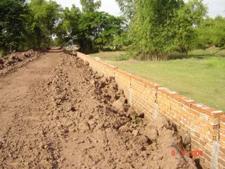
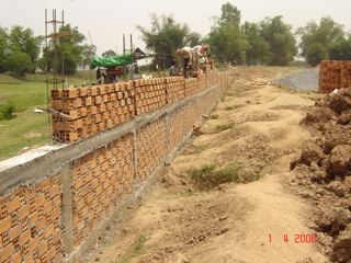
- On the front section of the land where the pockets are deep (up to 3 meters), a wall made of bricks and cement will be erected to retain the soil.
- The land excavation and filling together with the bricks and cement wall works took about 2 months to complete, from mid march to mid may 2006.
- 35,000m3 of soil was removed and used to do the small road and fill in the pockets.
320 meters long of bricks and cement wall was erected with height from 1,00 to 3,20 meters.
Cost for the above works: US$40,000
Vetiver solutions:
Starting late June/early July, the Mekong water level goes up from 0 (base level during dry season) to reach its peak of 14 meters high (vertical drop) in October then goes down to reach level 0 by early/mid December. Because of the constant changes of water level during the raining season, the waves and strong current “eat” into the surface of the soil with loss of up to 1 meter deep of the slope surface. Therefore, the soil surface must be protected.
Conventional means such as rocks, steel and cement will be very expensive and might not be a permanent solution since water will attack from below and the sides, including both neighbors’ land.
This is where vetiver could offer a solution.
The main issue with planting vetiver on the slope is its survival chance below water. Indeed, a large portion of the slope, hence most of the vetiver, will be under water for 3 to 4 months.
Vetiver nursery and planting:
Since I could not find any vetiver (V.zizaniodes) in Cambodia and the quantity required was large, I had to bring tillers from the Land Development in Thailand, (in June and in July 2006) to start a nursery, for which I had allocated 1 hectare (10,000 m2) of land with fences to protect from humans and cows.
Preparation:
- Shade and humidity: when the tillers arrived, they were not in a good shape, 20% had died during transportation since the driver didn’t take proper care of them. We had to store them under a shelter, sprayed them with water then dipped their roots to the ground filled with water.
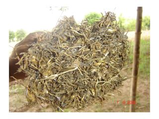
- Tillers preparation: we cut the tillers to 30cm and the roots to 5 cm. Then tied them to form bunches of 50 tillers each.
- Roots dipping: in water for 7 days, “horse tea” for 1 week or “mud gravy” instantly before planting, all worked well but the “mud gravy” saved time.
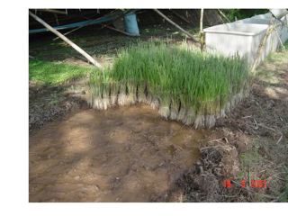
- Raised beds: for planting, 1 meter, 2 shoots at 50cm interval and for walking, 1 meter.
- Lots of water and lots of sun, no fertilizer used only animals manure
- Cut leaves to 50cm after 1 month to accelerate tillers multiplication, then cut again in 3 months.
- After 5-6 months, the vetiver are matured and the clumps are thick with a average of 50 tillers.
Planting:
The water level started to go down in mid November, so we had to plant vetiver on the slope as soon as possible to enable the grass to fully mature before the water levels start to come up again.
We dug the clumps out, cut the leaves to 30cm, separated the tillers, cut their roots to 5cm, dipped the roots in the “mud gravy” then planted on the slope in the following manner:
- parallel to the river flows: 1 plant every 10cm interval, rows every 1 meter
- perpendicular to the river flows: 1 plant every 20cm, rows every 2 meters.
- Add fertilizer to accelerate their growth since we want fully mature vetiver as soon as possible.
Cut the leaves to 30cm after 1 month to accelerate tillers multiplication, then another cut after 3 months. - Lots of water and sun shine.
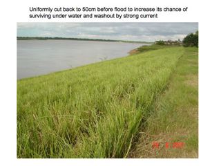
Vetiver action: in mid May, the vetiver are fully grown, thick and very nice green colour. AND ready to face the flood. One final touch: just before the water level started to cover them, we cut the grass to 50cm to increase their chance of survival under water.
The vetiver will “nail” the slope surface to the ground. Their leaves will prevent the waves and strong currents to “eat” into the soil surface. They will also retain some of the soil brought in by the Mekong. The only question: will they survive?
Current situation and summary
We learned a lot from this first 18 months:
The Vetiver grew well and my farmers were experts at planting the grass. The hedgerows were planted well and grew well.
We found to our surprise that a lot of silt was deposited on the lower section of bank and the cut vetiver was smothered and died, however where it was not cut it survived up to six months of muddy water. We have replanted these areas. We will not cut back the vetiver again.
We now face another problem. Below the toe of the slope there is a vertical drop of 5-6m to the river bed, this is always covered with water and the current is eroding and cutting into it causing collapse above. I am now working out how to deal with it. It is not easy taming the mighty Mekong.
We will let you know how we deal with this later
On a personal note, the project would not have been possible without the help of experts from the Vetiver.org and Land Development (and also the Internet) and I would like to particularly thank Mr. Richard Grimshaw, Mr. Paul Truong, Mrs. Suwanna Pasiri and Mr. Arthit Sukhkasem and all others who have been advising me all along the project.
Tuon Van
March 2008
The dry season low flow erosion that is currently taking place could be a bit of a problem. Below is a note from Tran Tan Van, Geologist and Vietnam Vetiver Network Coordinator:
River bank erosion can take place in one of the following forms, or in combination of them:
1. Slow, gradual, either continuous or seasonal soil erosion;
2. Shallow, small slide, having failure surface within 1-2 m below the bank surface; and
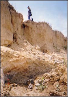
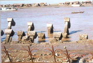
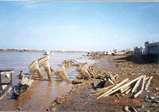
3. Large, deep slide, having failure surface sometimes exceeding a few tens of m below the bank surface. So the failure surface can "daylight" in some cases far deeper in the channel bed. This is rare but happens. I attach a few photos of such as case in Bac Lieu province (downstream of Mekong), where a whole fishery jetty collapsed. You can see the caps of the piles. They are more than 20-30 m deep. The jetty cost US$ 3m to built. Vetiver can't work in this case, but it can for the first two.
Usually, river bank erosion starts from No. 1, leading to No. 2 and finally No. 3. So in that sense, it is much better to prevent erosion right from the beginning when everything is still simple and cheap and that is where Vetiver is most appropriate to use.
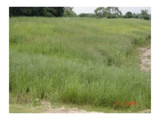
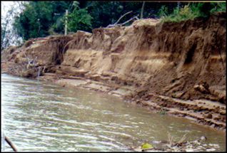
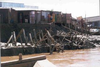
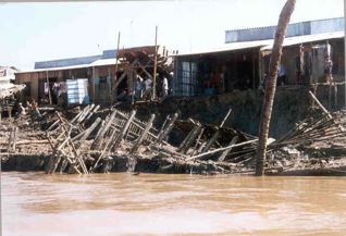
Attached are few more pictures of river bank erosion in Vietnam to compare the extent at this (Tuon) site.
Bank erosion here is just between No. 1 and No. 2 as described above. It is mostly due to surface actions like wave, near-bank flow, tide, interaction between groundwater and river water. The bank may gradually retreat, its height and slope become higher and steeper until a moment when No. 3 case may happen, which requires seasons, or years.
Unfortunately, people tend to ignore No. 1 and No. 2. And when No. 3 does occur they tend to exaggerate the disaster and want to apply rigorous and expensive engineering measures.
The only problem at this (Tuon's) site, is that the lowermost row doesn't grow well. It happens also in Vietnam and we tend to explain it by: 1) the clayey soil; and 2) which is always too wet.Some more from Tran Tan Van
"We had a few years ago a project on geohazards (including river bank erosion) assessment in several coastal provinces of Central Vietnam. There we had quite a lengthy presentation on bank erosion of 25 largest rivers of Central Vietnam, and quite lengthy explanation of the cause. And we had a section about the timing of the erosion. We noted that:
1. Erosion doesn't occur when the water is rising, but when it starts to go down;
2. Furthermore, erosion also takes place during the driest season, when the water level is lowest; and
3. It takes place most severly when the water level changes suddenly.
Our explanation is that when the river water goes down quickly, it becomes lower than the ground water table onshore, forcing the groundwater to flow to the river. If this happens quickly enough then inside the soil, the so-called "Excess negative pore water pressure" builds up and can not dissipate. And this is equivalent to an additional surcharge on to the soil, causing it to fail.
In this regard, planting Vetiver is a very good measure because among others it helps dissipate the pore water more quickly and more evenly.
In Tuon's project the Vetiver is also planted perpendicularly to the river flow and it is very good. But maybe it would be better if he reduces the distance between tillers from 20 cm to 10 cm.
Finally, if Vetiver alone doesn't work then a combination with the so-called geotextile turf for the lowermost part of the bank may work and this measure is also a lot cheaper than what the Vietnamese dyke department is now doing. The geotextile turf can be both degradable (made from jute) or non-degradable (synthetic). It is kind of a net, helping bind the soil in place while still alowing local vegetation to establish. We had a demo site along the Huong river in Central Vietnam in 2000 and it is still there now, with local grass fully covering, very nicely".
.
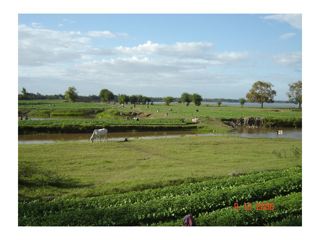  |
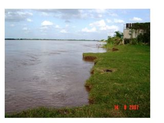
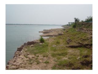
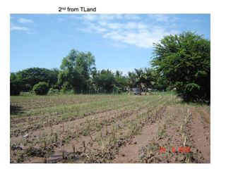
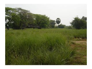
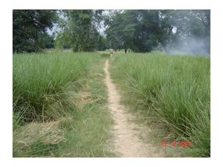
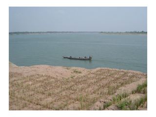
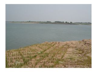
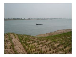
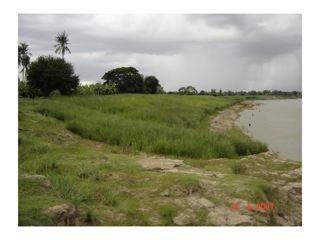
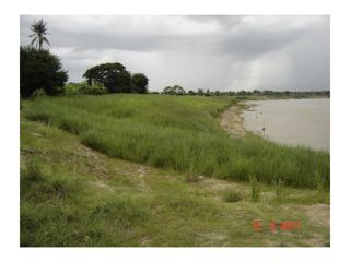
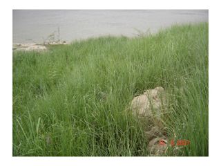
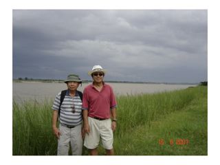
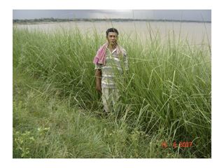
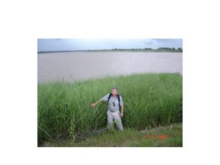
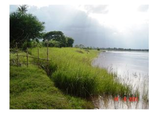
General View of my farm on the Mekong River. |
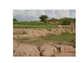
The Problem - A huge one!! |
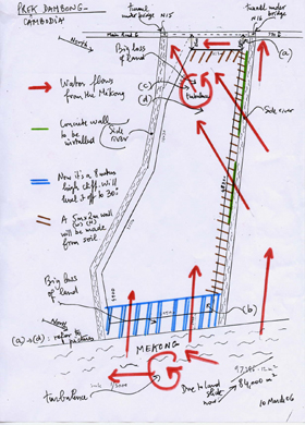 |
| In the diagram above the blue lines represent the eroded "cliffs" adjacent to the Mekong. These were reshaped and planted to vetiver. On each side of the farm are two waterways extending from the Mekong and back under highway #6 (top of diagram). The right hand one floods when the Mekong is at full flood. To prevent flooding Tuon has built a dike reinforced in parts by a concrete wall (green lines). Red lines show direction of water flow. |
  |
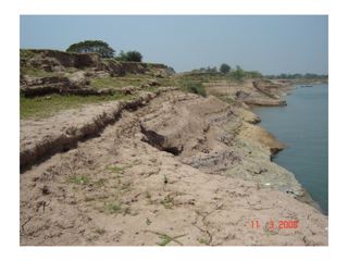
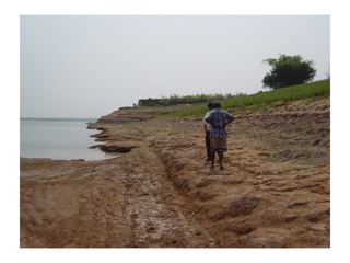
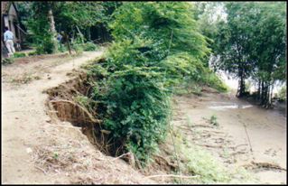
Typical erosion along the Mekong banks, my neighbors wall is about to be taken out by bank collapse! |
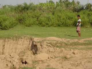  |
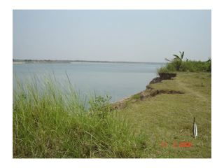
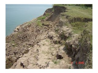
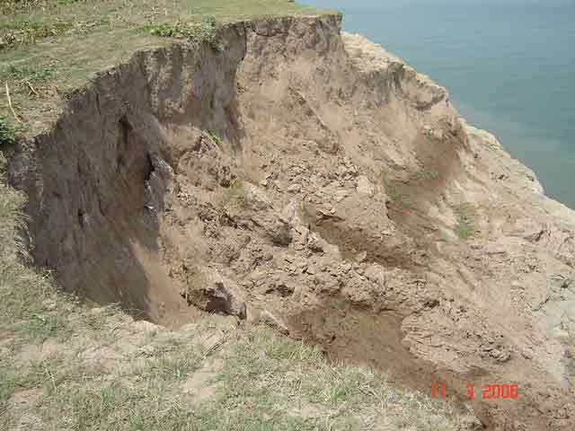
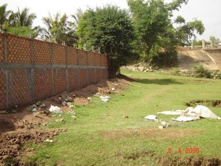
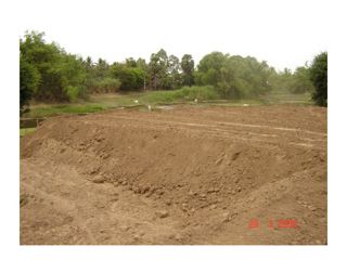
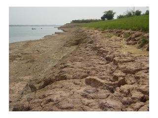
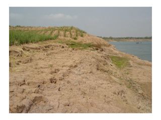
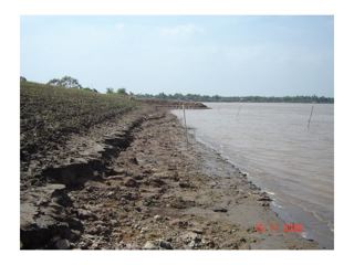
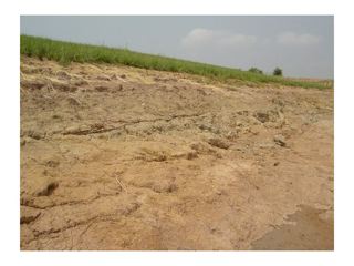
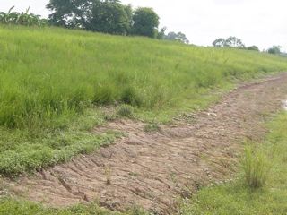
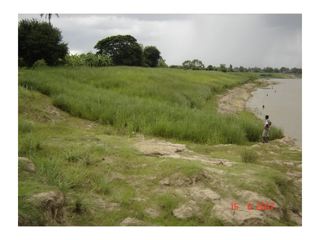
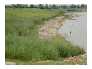
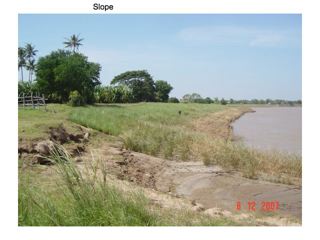
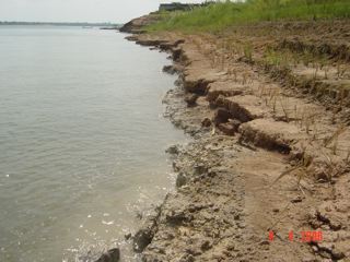
Erosion and Soil Loss on the banks |
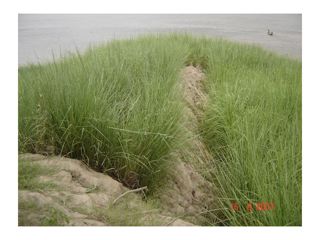
The next few images show the problems that we face with fast disappearing land. we have already lost 1 ha of land in the last 10 years. it is that flat base portion, at the base of the steep cliff banks, in contact with the water that keeps on "disappearing". The flat base can be from 2 to 7 meters wide (from the toe of the slope to the water). Some parts have no flat base, and the toe of the slope is also is in contact with the water and disappears. |
  |
  |
A wall was constructed along the waterway "canal" and reinforced with an earth bank. Highway #6 is in the background. |
   |
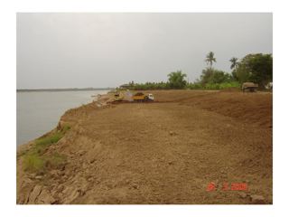
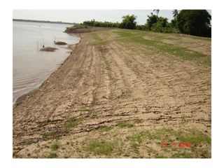
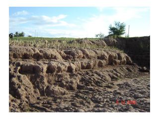
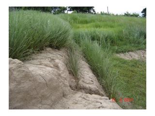
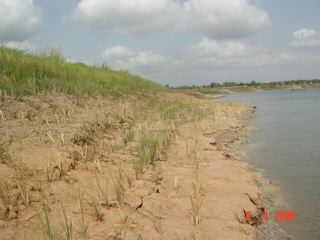
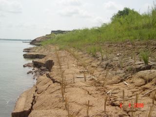
To stabilize the eroding bank "cliff" on the Mekong with vetiver we had to first reshape the bank, see below |
  |
 |
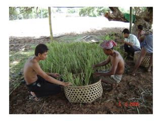
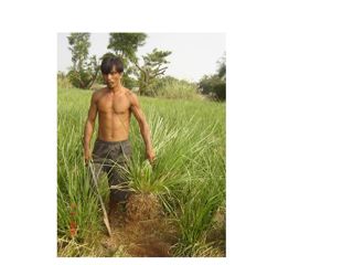
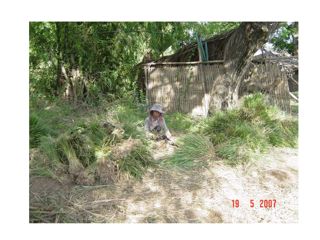
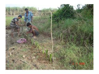
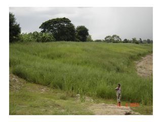
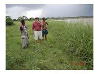
Whilst we were shaping the banks we brought in Vetiver grass from Thailand and started a nursery - turned out to be a very good one - I have excellent farmers!!
|
  |
  |
 |
  |
  |
  |
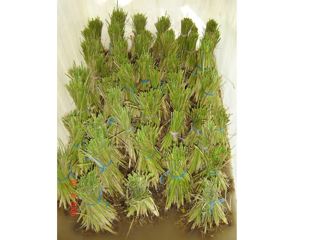
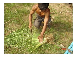
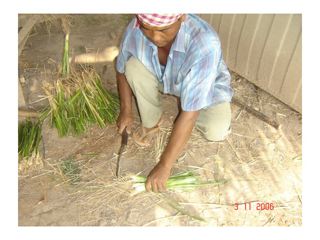
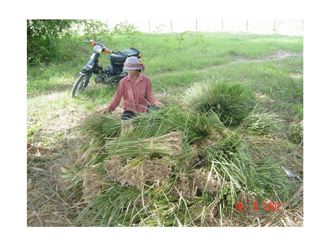
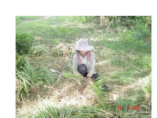
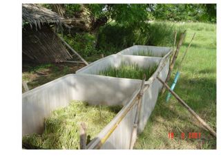
Our nursery developed quickly, and soon we were able to start harvesting the clumps of vetiver to divide into slips. The next few photos show the process including soaking the slips in "horse tea" a mud slurry and horse manure that due to its hormone content encourages root growth. |
  |
  |
  |
  |
  |
 |
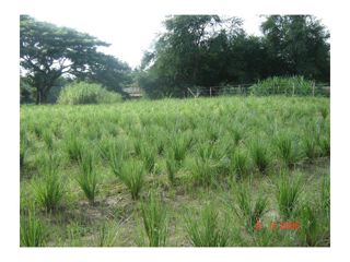
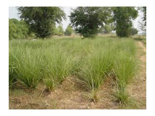
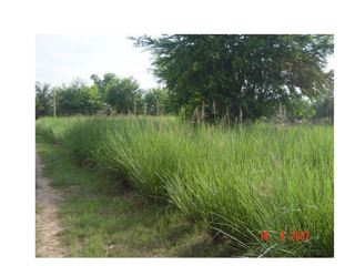
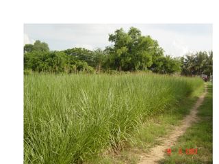
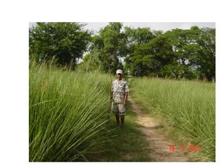
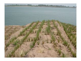
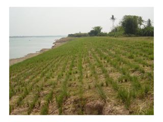
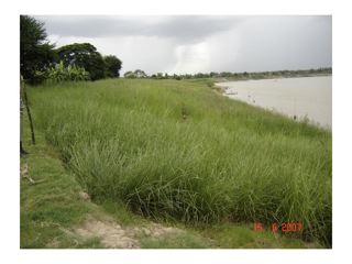
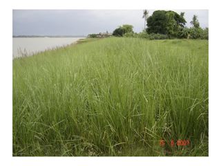
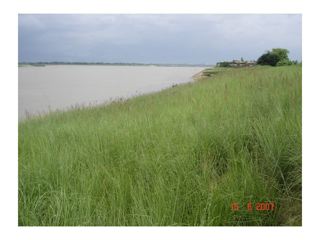
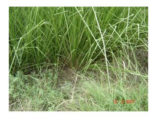
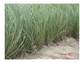
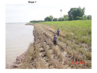
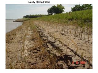
With our slips already for planting we planted vetiver rows across the complete bank on the contour. We also planted rows up and down the slope, these rows help protect the banks from current erosion |
 |
  |
  |
  |
  |
  |
  |
  |
  |
  |
  |
  |
  |
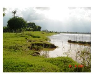
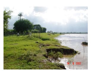
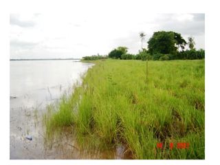
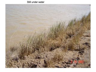
Before the FLOOD |
  |
  |
  |
  |
  |
  |
  |
  |
  |
  |
  |
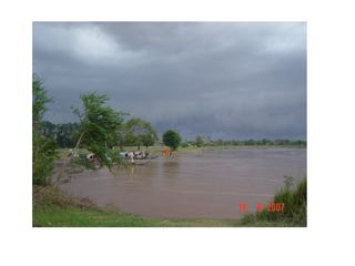
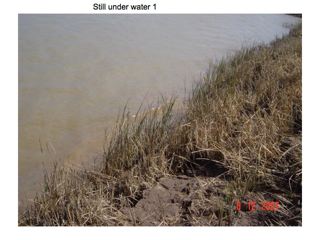
The Mekong water levels started to rise and eventually nearly all the vetiver was submerged, the lower rows for 6 months! |
We will know if the vetiver will survive once the water level recedes starting in November, i.e., in a month’s time. Let’s cross our fingers! |
  |
  |
  |
  |
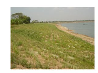
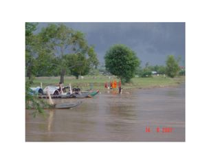
THE FLOOD RECEDES - NOV - DEC 2007 |
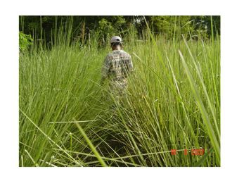
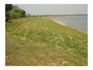
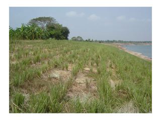
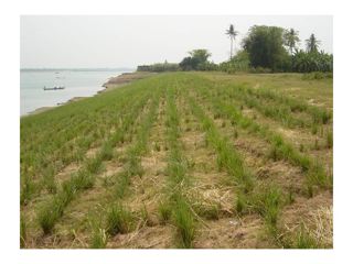
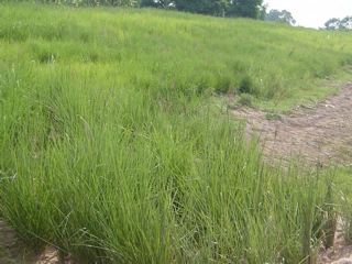
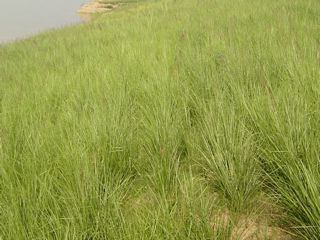
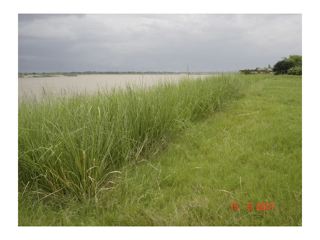
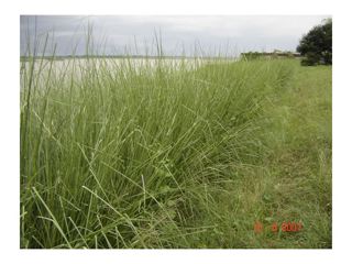
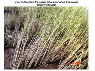
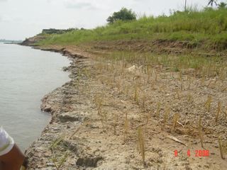
| The top rows (trimmed) below were only partially submerged. The bank has been fully protected and the plant continued to grow vigorously providing excellent protection against wave action. |
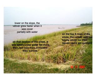 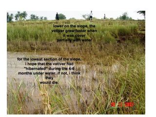 |
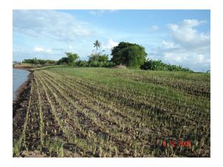
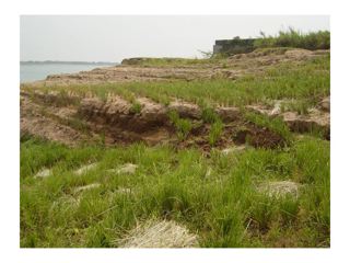
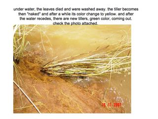
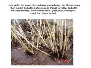
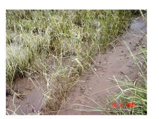
The lower rows were fully submerged for 3 months, the leaves have died back, but new growth occurs as the water levels recede. |
  |
  |
  |
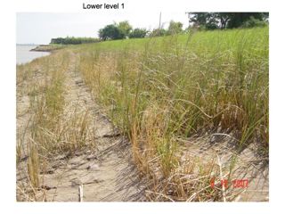 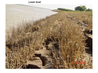 |
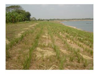
The lower rows were fully submerged for 3 months, the leaves have died back, but new growth occurs as the water levels recede. Note that instead of soil erosion there has been considerable silt deposition. |
  |
 |
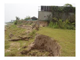
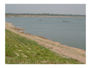
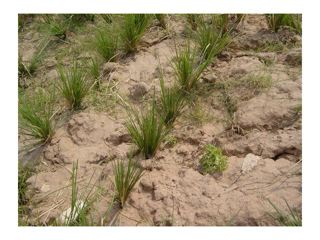
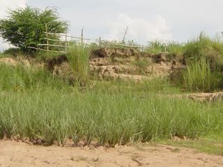
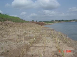
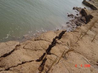
Dry Season low water bank erosion caused by current and wave action. The next few photos show some of the problems where the vetiver died. The area is being replanted. March 2008 |
  |
  |
  |
| In the above photo you can see mass soil loss about to take place where the vetiver has not been planted, this is because from the toe of the bank there is another steep drop down to the river bed, because of turbulence, currents, pore water pressure mass soil loss occurs. see Diagram below. The neighboring land has not been treated, and there is a cliff by building (left image) that juts out into the river, this creates further turbulance that is partly responsible for soil loss on Tuon's land.. Consideration is being given to flatten off this point and generally straighten out the whole river bank. |
 |
  |
 |
  |
  |